Breaking: New Selfie Captures Ancient Martian Terrain
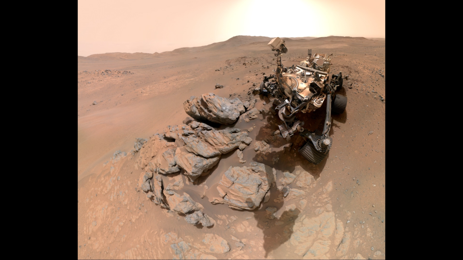
NASA's Perseverance rover has beamed back a dramatic new selfie from the western rim of Jezero Crater, exposing fractured cliffs and geological formations that hold keys to Mars' ancient past. The image, released Tuesday, shows the rover perched against a rugged backdrop of layered rocks and steep escarpments.

“This selfie gives us a front-row seat to a truly ancient landscape,” said Dr. Sarah Milkovich, a NASA planetary geologist. “Every cliff face tells a story of water, weather, and time.”
The rover's WATSON camera—part of the SHERLOC instrument—captured the wide-angle view, which required multiple overlapping shots stitched together over several days.
Background
Perseverance landed in Jezero Crater in February 2021, tasked with searching for signs of ancient microbial life and collecting rock samples for return to Earth. The crater once held a lake billions of years ago, making it a prime target for astrobiology.
The western rim where the selfie was taken is called the “margin unit” — a region rich in carbonate minerals that can preserve biosignatures. “We're driving uphill through history,” added Dr. Ken Williford, deputy project scientist for Perseverance. “Each layer is a page in Mars' geological diary.”
This image comes after the rover completed its first sample depot deposition, the first such cache on another planet.
What This Means
The selfie confirms that Perseverance is now exploring terrain that was once near the edge of the ancient lake. The fractured cliffs suggest periods of intense tectonic or impact activity, followed by erosion.
“These images allow us to reconstruct the timing of water flow and rock formation,” said Dr. Milkovich. “We're seeing the final chapter of a once-habitable environment.”
The findings will help mission planners decide where to collect additional samples for the upcoming Mars Sample Return campaign, a joint effort between NASA and the European Space Agency.
For scientists, the selfie is more than a striking picture—it's a data-rich map of a world that may have hosted life. As Perseverance continues its ascent, each new selfie could reveal the next piece of the Red Planet's puzzle.
- Key location: Western rim of Jezero Crater (margin unit)
- Camera used: WATSON on the SHERLOC instrument
- Mission milestone: First sample depot completed
Follow updates from Perseverance via background section above or check NASA's official blog for the latest images.